
GoMap__2026_10_23__16_48_57
- Distance: 2.0 Km
- Elevation gain: 10 m
- Maximum elevation: 385 m
- Elevation loss: 4 m
- Minimum elevation: 376 m
- Moving time: 28 m 2 s
- Moving speed: 4.2 Km/h
- Maximum speed: 5.1 Km/h
- Total time: 45 m 43 s
- Global speed: 2.6 Km/h
Interactive trail map
Trail profile
- Distance: 2.0 Km
- Elevation gain: 10 m
- Maximum elevation: 385 m
- Elevation loss: 4 m
- Minimum elevation: 376 m
- Moving time: 28 m 2 s
- Moving speed: 4.2 Km/h
- Maximum speed: 5.1 Km/h
- Total time: 45 m 43 s
- Global speed: 2.6 Km/h
About this trail
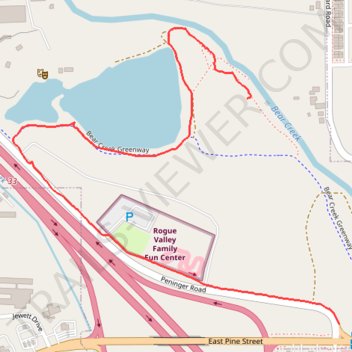
Name: GoMap__2026_10_23__16_48_57 trail, distance, elevation, map, profile, GPS track
End: Peninger Road, Jackson County, Oregon, 97502, United States (42.37909 -122.89983)
Coordinates: 42.37909 -122.90918 42.38537 -122.89983